Zoom Earth - Weather Forecast
Neave Interactive
Downloads
5,000,000+
Version
Latest
Advertisement
Click to download now, finish the installation quickly, and directly unlock the "all-round experience"
Advertisement
Screenshots


Click to download now, finish the installation quickly, and directly unlock the "all-round experience"
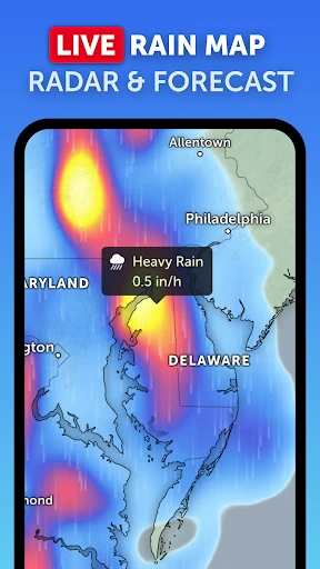
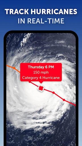
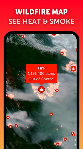
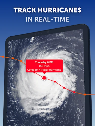
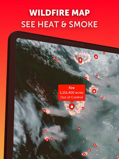
Zoom Earth - Weather Forecast represents a paradigm shift in the weather category, moving away from static numerical data toward a dynamic, visual-first experience. By leveraging near real-time satellite imagery and high-resolution map overlays, it provides a "global-to-local" perspective that few competitors can match. In the crowded landscape of weather apps, Zoom Earth distinguishes itself as an essential tool for situational awareness, particularly for users who need to visualize atmospheric movements, storm progression, and environmental hazards like wildfires in a spatial context.
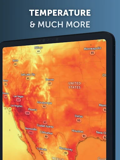
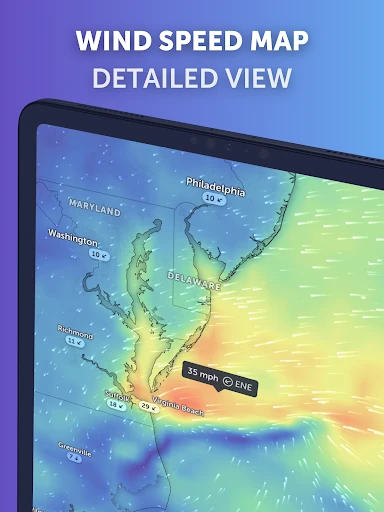
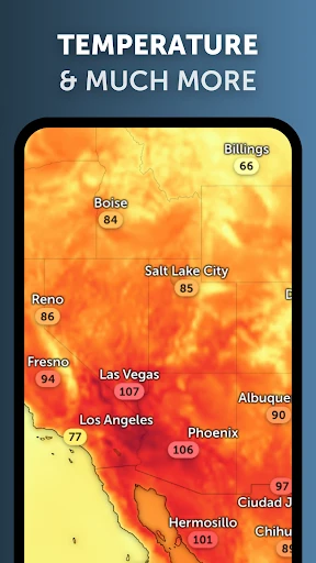
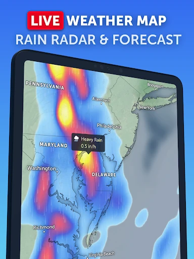
The user interface of Zoom Earth is remarkably clean, treating the entire planet as an interactive canvas. Unlike traditional weather apps that bury maps behind several menus, Zoom Earth makes the map the core of the experience. The layering system is intuitive, allowing users to toggle between temperature, wind, and satellite views without losing their geographical context. The animation of wind and rain flows is smooth, contributing to a high-end feel that prioritizes visual clarity over cluttered data tables.
To further enhance the experience, Zoom Earth could benefit from more granular, localized push notifications based on specific map layers—such as an alert when a wildfire heat spot is detected within a certain radius. Additionally, integrating educational tooltips for more technical layers like "Wet Bulb Temperature" would help bridge the gap between enthusiast and professional users. Finally, an offline map caching mode for specific regions would be invaluable for users in disaster zones where cellular connectivity is intermittent.
Zoom Earth - Weather Forecast is a premier choice for weather enthusiasts, pilots, travelers, and anyone living in areas prone to severe weather events. It is more than just a forecast tool; it is a global observation platform. While casual users might find the depth of data overwhelming at first, its visual beauty and accuracy make it one of the most compelling weather applications currently available on the Google Play Store. We highly recommend it for those who value seeing the weather as much as knowing the temperature.