Advertisement
Click to download now, finish the installation quickly, and directly unlock the "all-round experience"
Advertisement
Screenshots


Click to download now, finish the installation quickly, and directly unlock the "all-round experience"
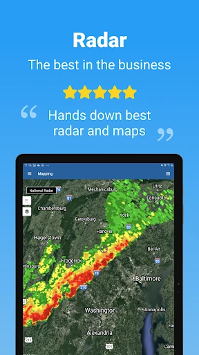
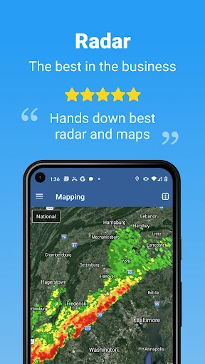
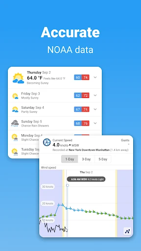
WillyWeather enters a crowded weather landscape with a distinct advantage: surgical precision. While mainstream competitors often provide generalized regional forecasts, WillyWeather distinguishes itself by processing and fine-tuning NOAA data for over 175,000 specific coordinates across the United States. This report finds the app to be a professional-grade tool masquerading as a consumer app, offering a depth of data—particularly regarding marine and UV conditions—that surpasses standard pre-installed weather utilities. It is a robust, data-centric platform designed for those whose daily routines or hobbies are dictated by the elements.
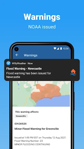
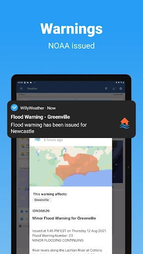
The UI of WillyWeather reflects a "utility-first" philosophy. Unlike many modern apps that sacrifice data density for white space and large icons, WillyWeather opts for a clean, organized layout that maximizes information delivery. The integration of Google Maps for its radar and satellite views provides a high degree of "UI familiarity," reducing the learning curve for new users. The standout UX feature is the scrubbing interaction on its forecast graphs, which feels responsive and allows for precise data extraction. While it may lack the "flashy" animations of some aesthetic-focused competitors, its logical structure ensures that critical information—like UV alerts or NOAA warnings—is never more than a tap away.
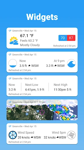
To reach a broader audience, WillyWeather should consider expanding its hyper-local processing model to international territories. Additionally, the implementation of more customizable home-screen widgets would be a significant upgrade, allowing users to track specific data points like tide times or wind speeds without needing to fully launch the application. Integrating "push-to-alert" notifications for specific wind or swell thresholds would also enhance its utility for the outdoor sports community.
WillyWeather is specifically tailored for "power users" of the outdoors—surfers, hikers, fishermen, and professionals who require technical accuracy over aesthetic flair. It successfully bridges the gap between a standard weather forecast and a professional meteorological tool. For the average user, it is a highly reliable backup; for the coastal or outdoor enthusiast, it is an essential utility. This app is highly recommended for anyone whose safety or success depends on the specific nuances of the local environment.