Advertisement
Click to download now, finish the installation quickly, and directly unlock the "all-round experience"
Advertisement
Screenshots
Click to download now, finish the installation quickly, and directly unlock the "all-round experience"
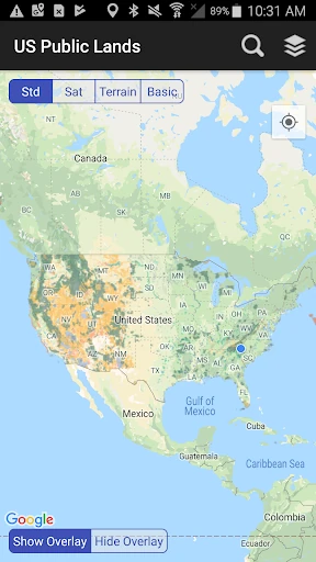
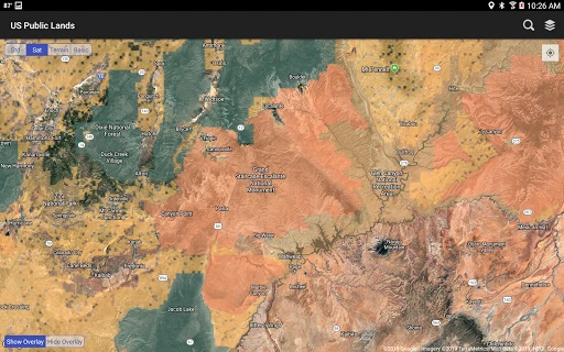
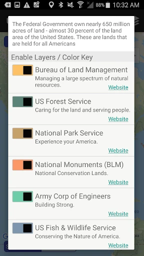
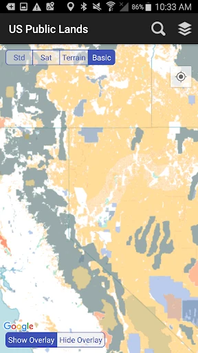
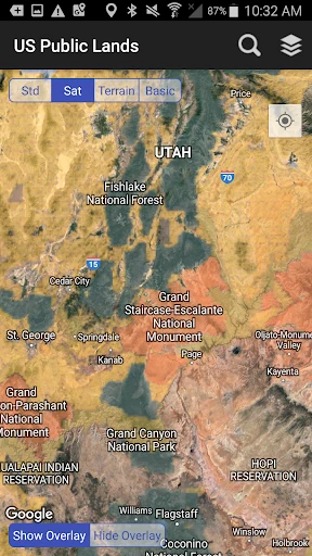
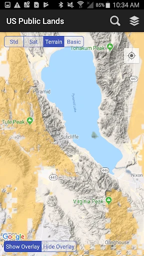
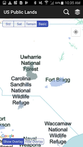
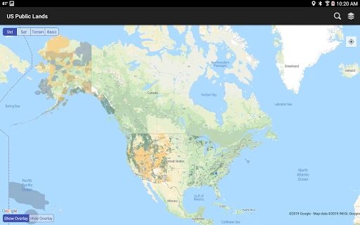
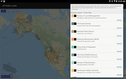
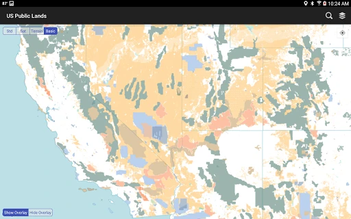
US Public Lands stands as a specialized and indispensable utility within the Travel & Local category, designed specifically for the outdoor enthusiast who requires precision in land ownership data. While many navigation apps focus on roads and points of interest, this tool addresses a critical niche: the identification of federal land boundaries across the 650 million acres owned by the US government. By translating complex geospatial data into a mobile-friendly format, it provides a level of situational awareness that was previously reserved for professional surveyors or those carrying cumbersome physical maps. It is an authoritative companion for boondockers, hunters, and hikers who must navigate the legal complexities of Bureau of Land Management (BLM), Forest Service, and National Park Service territories.
The interface of US Public Lands prioritizes utility and functional density over aesthetic flair, which is a standard and often preferred approach for GIS-based tools in the Travel & Local space. The UI is built around a "layers-first" philosophy, making it easy to toggle between various federal agencies. The design successfully avoids "menu diving" by keeping essential tools—like the search bar, GPS locator, and layer toggles—within a single tap's reach. While the visual style may feel utilitarian to a casual user, it provides the high-contrast clarity necessary for outdoor use under bright sunlight or in stressful navigation scenarios.
To further elevate the user experience, future updates should consider implementing offline search capabilities for major landmarks and coordinates. Additionally, the integration of a "waypoint" system—allowing users to drop pins and save custom notes or photos for specific camp spots—would transform the app from a reference tool into a comprehensive trip planner. A visual indicator or "buffer zone" warning for potential private inholdings would also add an extra layer of security for users navigating near ambiguous boundaries.
US Public Lands is a must-have tool for boondockers, overlanders, and backcountry explorers who frequent the American West. It is not a general-purpose tourism app, but rather a professional-grade reference for those who prioritize legal compliance and remote exploration. We highly recommend this app for any traveler who plans to venture off the grid and needs to know exactly where public access ends and private or restricted property begins.