Advertisement
Click to download now, finish the installation quickly, and directly unlock the "all-round experience"
Advertisement
Screenshots


Click to download now, finish the installation quickly, and directly unlock the "all-round experience"
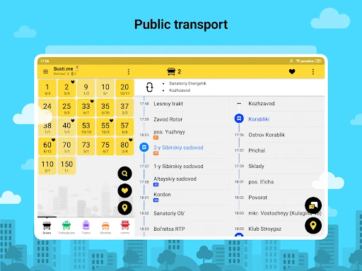
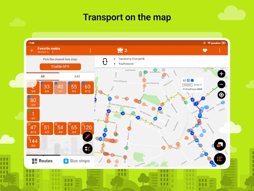
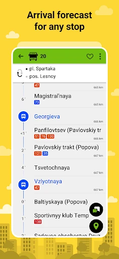
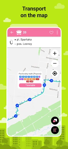
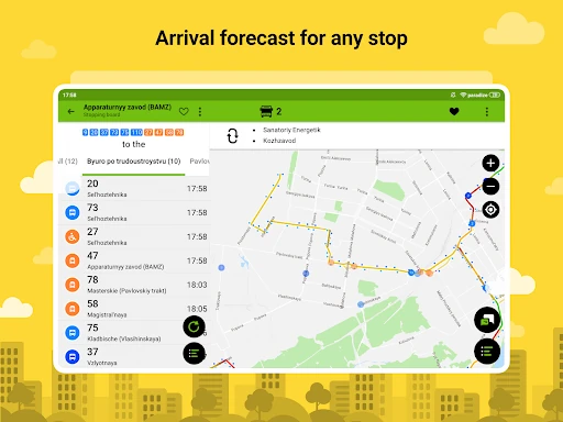
Bustime establishes itself as a robust, community-driven contender in the Maps & Navigation category, offering real-time public transit tracking across over 400 cities. In a landscape often dominated by generic mapping tools, Bustime carves out a niche by prioritizing granular GPS/GLONASS data and high levels of user customization. It functions not just as a static schedule viewer, but as a dynamic utility that bridges the gap between municipal transit data and the daily commuter's need for precision. Its authoritative approach to data sourcing—cooperating directly with government agencies—gives it a level of reliability that is essential for urban navigation.
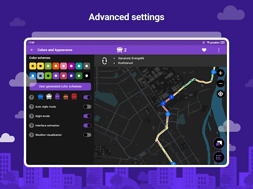
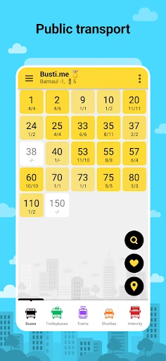
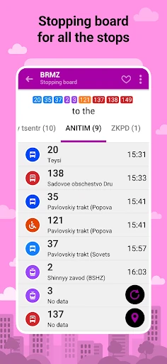
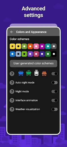
The user interface of Bustime prioritizes functional efficiency and speed over modern aesthetic minimalism. While it may appear utilitarian compared to contemporary design trends, this choice ensures high performance and low resource consumption on a wide range of devices, including older tablets and budget smartphones. The modular, tile-based layout is highly responsive, and the deep personalization options allow users to transform a standard navigation tool into a bespoke dashboard. The UX is clearly designed for the "power commuter" who requires dense information at a glance rather than a guided, step-by-step onboarding process.
To further elevate the user experience, the developers should consider a modern UI overhaul that adopts Material Design 3 principles to make the interface more cohesive. While the "small size" of the app is a benefit, the "thrilling game" feature could be moved to a secondary menu to declutter the primary navigation path. Additionally, integrating predictive AI to estimate delays based on historical traffic patterns—rather than just current GPS location—would provide a more comprehensive "Arrival Time" experience.
Bustime is an indispensable tool for daily commuters, students, and city dwellers who rely heavily on public infrastructure. It is particularly well-suited for users who find mainstream navigation apps too simplistic or lacking in accessibility options. While it may require a slight learning curve to master its deep customization settings, the payoff is a highly personalized and accurate transit companion. We highly recommend this app for any user living in its 400+ supported cities who values data transparency and real-time reliability over cosmetic flair.